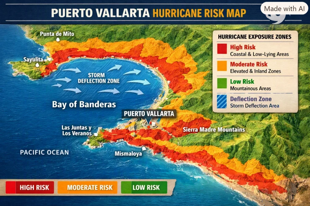

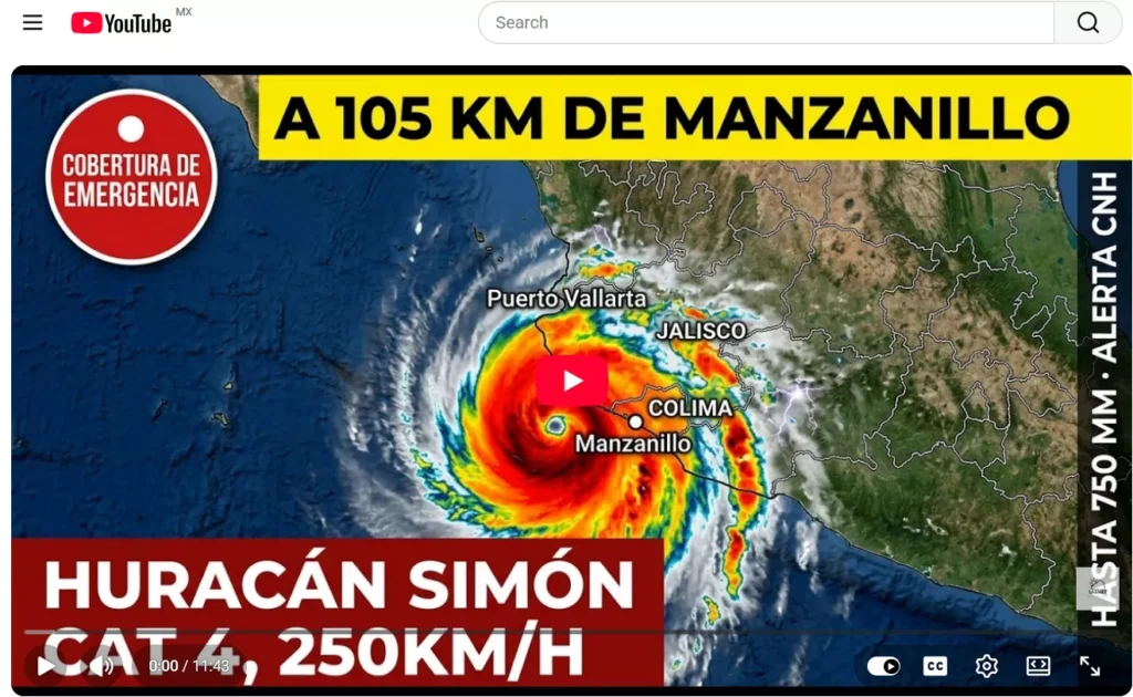
Here’s the reason why hurricane stays away from Puerto Vallarta — it highlights Puerto Vallarta, the Bay of Banderas, and surrounding areas with color‑coded zones showing high, moderate, and low risk, plus the storm deflection zone over the bay.
🗺️ How to Read the Map
- Red (High Risk) → Coastal & low‑lying areas like Puerto Vallarta, Punta de Mita, and Mismaloya.
- Orange (Moderate Risk) → Elevated inland zones such as Sayulita and Las Juntas y Los Veranos.
- Green (Low Risk) → Sierra Madre Mountains, where storms weaken quickly.
- Blue (Deflection Zone) → Bay of Banderas, where many hurricanes curve away before landfall.
This visualization shows why Puerto Vallarta is relatively shielded: the bay often pushes storms out to sea, while the mountains weaken those that do approach. Still, as history has shown, strong hurricanes can break through these defenses.
Puerto Vallarta rarely experiences direct hurricane strikes because of its unique geography: the Bay of Banderas and the Sierra Madre mountains tend to deflect or weaken storms, though history shows that powerful hurricanes like Kenna (2002) and Lidia (2023) have still caused significant damage. In short, the city is relatively protected compared to other Pacific coast towns, but not immune.
🌊 Why Hurricanes Often Miss Puerto Vallarta
Geographic Factors
- Bay of Banderas:
- The bay’s large, curved shape disrupts storm paths.
- Many hurricanes approaching the coast are pulled out to sea or redirected northward before hitting Puerto Vallarta directly.
- Sierra Madre Occidental Mountains:
- Rising sharply behind the city, these mountains act as a secondary barrier.
- Even if a storm makes landfall nearby, the rugged terrain weakens it quickly, reducing wind strength and rainfall intensity.
Historical Evidence
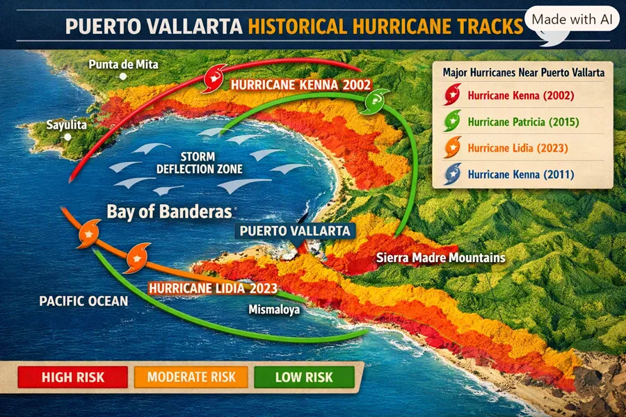
- Hurricane Kenna (2002): Category 5 storm that struck near San Blas, Nayarit. Puerto Vallarta still suffered winds up to 225 km/h and waves of 5–6 meters damaging the Malecón.
- Hurricane Patricia (2015): The strongest Pacific hurricane ever recorded, made landfall south of Puerto Vallarta. The city experienced tropical-storm-force winds and heavy rain.
- Hurricane Lidia (2023): Category 4 storm that hit near Las Peñitas, Jalisco, causing flooding, power outages, and damage to over 1,800 homes in the region.
✅ Key Takeaways
- Direct hits are rare: In the past 35 years, Puerto Vallarta has had only one major direct strike.
- Protection is partial, not absolute: The bay and mountains reduce risk but cannot guarantee safety. Strong hurricanes can and do impact the area.
- Rainy season ≠ hurricane season: Most storms weaken or divert before reaching Puerto Vallarta. Daily showers from June–October are common, but hurricanes are infrequent.
⚠️ Risks & Misconceptions
- Myth of immunity: Many locals believe “Puerto Vallarta doesn’t get hurricanes.” This is dangerous—Kenna and Lidia proved otherwise.
- Storm surge & flooding: Even without a direct hit, the city can face coastal flooding, river overflow (like the Cuale River in 2023), and infrastructure damage.
- Preparedness is essential: Emergency planning, reinforced structures, and evacuation awareness remain critical.


📌 Conclusion
Puerto Vallarta’s geography makes it one of the least hurricane-prone cities on Mexico’s Pacific coast, but not hurricane-proof. The Bay of Banderas and Sierra Madre mountains often deflect or weaken storms, yet history shows that powerful hurricanes can still cause serious damage. Residents and visitors should remain cautious during hurricane season (June–November), especially in peak months (August–October).